In addition to private hiking trails and roads on our farm, there are an overwhelming selection of nearby hiking trails and waterfalls in the Blue Ridge Mountains of North Carolina. Here are some of the favorites. Please see us at check-in for maps, directions and more information!
We have a great option for hiking right here on the farm: an easy trail that follows an old logging road through the forest, then along the upper pond. It then passes the Hammock Island lily pad pond, finishing up along side of The Historic Albertus Ledbetter House.
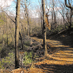 Big Rock Candy Mtn Hiking TrailBig Rock Hiking Trail
Starting from the office, this trail goes up the road past “The Reach” and then straight up nearly to the top of our mountain, then around and down, finishing over by “The Bimini Twist” cabin. This new loop trail we call the “Big Rock Trail” totals 2.5 miles. It is a climbing then rolling walk through a forest of hardwoods, mountain laurel (or ‘Ivy’ as the locals call it) and rhododendron. It passes a huge rock formation with some boulders as big as a Boeing 747! When combined with our less strenuous trail, which leads past main house and around the ponds, it makes for nearly five miles of trail. There are several places to stop along the way to take in the natural beauty, and if lucky enough perhaps see a deer or wild turkey.
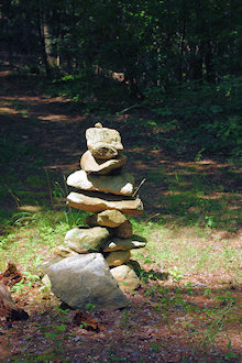
We are also inviting folks to build their own small rock monument along the trail in remembrance of their stay or as a memorial etc. This is similar to the rock piles folks leave in Aruba and Peru. It will be a great way to have folks return to check on their creation or to add another or just to enjoy others works. This has already started with folks building their own rock sculptures along some of the roads to the cabins.
Scenes from our Big Rock Hiking Trail, a 2.5-mile loop hike up a mountain to a ridge with a picnic table waiting for you! Remember to fill up your water bottles with our fresh spring water.
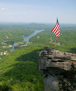 Chimney Rock Park: This beautiful park has several short hiking trails packed with beautiful scenery. As an option to the elevator to go to the top of the chimney, take the Outcroppings Trail, a network of stairs and boardwalks either to or from the Chimney level. Choose your path of adventure—head up to visit the Rock and the awesome views of Hickory Nut Gorge hike up to the Rock and gaze at the amazing natural phenomenon where you’ll get some great photos. The Hickory Nut Falls trail is a 1.5-mile roundtrip hike to the bottom of the 404-foot Hickory Nut Falls. Along the Skyline Trail Stop at the Opera Box for great views of the chimney and Lake Lure and be sure to see the Devil’s Head. Stop by the Moonshiner’s Cave, and take a short stroll to the parking lot. Get your heart pumping on the one-mile roundtrip Four Seasons Trail with an over 400ft elevation gain. The trail winds through hardwood forest, rhododendron and mountain laurel thickets and abundant wildflowers as well as rare and indigenous plants, some species not found along the Park’s other trails.
Download the PDF of the Chimney Rock Park Hiking Map.
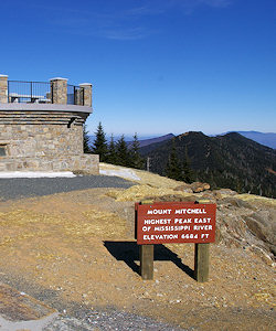 Mt. Mitchell: Explore the tallest mountain east of the Rockies! There is no admission fee to this state park. You can drive to the top and take a short trail to the stone observation platform. On a clear day, visitors can see as far as 85 miles and enjoy spectacular views of the surrounding mountains and the Pisgah National Forest. There are several hiking tails there. Choose between a short stroll (like the Balsam Trail) or a more extensive hike into the woods. For great views of Mount Mitchell from Mount Craig (6,645 feet, the second highest peak in the eastern United States), take a two-mile roundtrip hike through a Canadian-like forest. Deep Gap Trail begins at the picnic area near the beginning of the summit parking area. You will descend Mitchell and climb to the peak of Craig. The hike includes a good bit of climbing, but it is not overly strenuous. If you want to go farther, Deep Gap Trail continues for another 3.5 miles and crosses three more peaks above 6,000 feet. The Mount Mitchell Trail is long, strenuous hiking trail leads from the Black Mountain Campground to the summit. Most of the trail is on USFS property and climbs 3,600′ in 5.5 miles. It’s steep and rough in sections, but there are spectacular views. Hikers should wear appropriate clothing and carry proper gear as the high altitude makes the climate of Mount Mitchell chilly, even in summer.
Download the PDF of the Mt. Mitchell Hiking Map.
 Craggy Gardens: Craggy Gardens is a very popular spot along the Blue Ridge Parkway, at Milepost 364, just 24 miles from Asheville. The elevation is 5,500 feet, so views are spectacular on a clear day. This area is also famous for the large expanses of native rhododendron cover the slopes and summits of the Craggies that bloom in June. The Great Craggy Mountains are an area of exposed rock surfaces and high peaks that provides breathtaking vistas of distant southern Appalachian ridges. The best trail there is the Craggy Pinnacle Trail, a 1.5 roundtrip to the top of the mountain for 360-degree views. The trail goes through tunnels of rhododendron, gnarled sweet birch trees and wildflowers.
Another great trail is the Craggy Gardens Trail, accessed from the south end of the Visitor Center Parking area or from the north end of the Picnic Area. From the Visitor Center, the trail begins as a self-guided nature trail with a moderate uphill climb for .3 mile to a large trail shelter. A short spur to the left crosses the rhododendron bald to a overlook. If you begin at the Picnic Area, it’s a .8 mile uphill hike to the shelter and bald area.
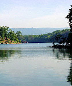 Lake James State Park: Tucked away in rolling hills at the base of Linville Gorge is Lake James, a 6,510-acre lake with more than 150 miles of shoreline. This impressive waterway is the centerpiece of Lake James State Park. Here, nature offers scenic vistas of the Appalachian Mountains. A half-mile trail leads to Sandy Cliff Overlook, and a 1.5-mile trail leads through the campground to Lake Channel Overlook. Fox Den Loop Trail is the park’s longest trail at 2.2 miles. Nearby, a number of other launching sites and marinas offer boats and motors for rent. Fishing tackle, bait, ice and snacks are also available. Cool, deep waters and warm surface waters provide a variety of sport fishing.
Download a PDF of the Park Map.
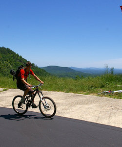 Point Lookout Trail: This paved trail in nearby Old Fort is great for both bicycling and hiking. Surrounded by Pisgah National Forest and barricaded to motorized vehicles at both ends, it was formerly part of Old US Highway 70, winding through the woods with serene views of the mountains, the railroad and forest. While the trail is only 3.6 miles one way (plus another 1/2 mile from the parking area), it climbs 900 feet in elevation from Old Fort to Ridgecrest (near Black Mountain). Its an eight mile roundtrip from the Pisgah Forest picnic area parking. Nearby is Andrews Geyser, a great picnic spot.
See the Point Lookout Trail Guide for more. Also watch the video below!
For more hiking trails, see the Top 50 Hikes in the NC Mountains.

